

Flooding Doesn’t Care About Lines on a Map: Why Checking FEMA Isn’t Enough in Tulsa
When evaluating a home, acreage tract, or commercial lot anywhere in the Tulsa metropolitan area, one question belongs at the very top of your due diligence checklist:
Can this property flood?
Flooding is the single most common and financially devastating natural hazard in the United States. Just one inch of standing water inside a finished home can easily cause $25,000 to $30,000 or more in physical damage, ruining subfloors, destroying drywall, and spawning toxic mold behind baseboards.
To protect their investment, most buyers do what standard real estate advice suggests: they check the FEMA Flood Map Service Center. They pull up the Flood Insurance Rate Map (FIRM), enter the address, and look for their parcel.
When the property sits in clear, unshaded terrain marked Zone X (Area of Minimal Flood Hazard), buyers breathe a sigh of relief. The mortgage lender confirms that flood insurance is not mandatory for loan approval, and everyone assumes the property is safe.
In Tulsa, Oklahoma, that assumption can be an expensive mistake.
Relying solely on a federal flood map is a gamble. While checking FEMA is a necessary first step, a clean federal map is not proof that land will stay dry. Water follows gravity, soil saturation, and local terrain—not lines drawn on a federal chart.
To uncover genuine flash-flood exposure—and whether the city will allow you to build, expand, or add dirt—you must take the second step: checking the City of Tulsa Regulatory Floodplain Map Atlas.
1. Why Water Ignores Paper Boundaries
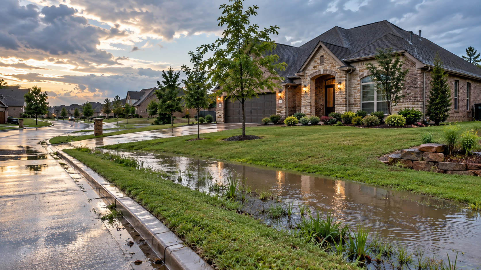
Before reviewing maps and engineering standards, it is vital to understand how flash floods behave across northeastern Oklahoma.
Over 25% of Flood Claims Happen in Low-Risk Zones
According to long-term data from FloodSmart (The National Flood Insurance Program), more than one in four flood insurance claims occur on properties mapped outside high-risk flood zones (such as Zone X). Runoff does not stop at lines on a chart when rainfall overwhelms local topography.
The Mechanics of Green Country Flash Floods
Northeastern Oklahoma frequently experiences intense storm systems capable of dropping 4 to 8 inches of rain in just hours, as tracked by the Oklahoma Climatological Survey. When that happens:
Clay soils saturate rapidly: Heavy native clay has very slow percolation rates. Once saturated, nearly all additional rain becomes rapid surface runoff.
Overland sheet flow builds: Excess water sheets across lawns, pools against exterior walls, and rushes down sloped driveways seeking low ground.
Neighborhood tributaries rise fast: Small local streams—like Mingo, Joe, Fred, Little Haikey, and Crow Creeks—surge from trickles to raging torrents in under an hour. As noted by the National Weather Service Tulsa WFO, just six inches of fast-moving water can knock down an adult, and twelve inches can carry away a car.
Loan Approval vs. Physical Safety
The most common trap for buyers is confusing two separate realities:
Mortgage Compliance: The federal rule requiring lenders to enforce flood insurance if a structure sits in a designated Special Flood Hazard Area (SFHA).
Physical Dryness: Whether rainwater will physically enter your crawlspace, garage, or living room during a major storm.
If a lender does not require flood insurance, they are simply saying federal regulations do not force them to mandate it. That is not a guarantee that your land will never flood. If floodwater enters your home, the financial burden falls entirely on you.
2. Step 1: Check the FEMA Flood Map (The Federal Baseline)
Every property check begins with FEMA maps, which establish flood risk zones nationwide:
Zone A & Zone AE (Special Flood Hazard Area - High Risk): The "100-year floodplain," meaning a 1% or greater chance of flooding in any single year (a 26% cumulative chance over a 30-year mortgage). Lenders mandate flood insurance here. Zone AE includes established Base Flood Elevations (BFE).
Zone AH & Zone AO: Areas of shallow sheet flow or ponding, usually 1 to 3 feet deep.
Zone X (Shaded - Moderate Risk): The 500-year floodplain (0.2% annual chance). Insurance is optional for lenders but highly recommended.
Zone X (Unshaded - Minimal Risk): Areas outside the 500-year floodplain. Lenders do not mandate flood insurance.
Why FEMA Maps Leave Blind Spots
While essential, FEMA’s nationwide mapping has built-in limitations:
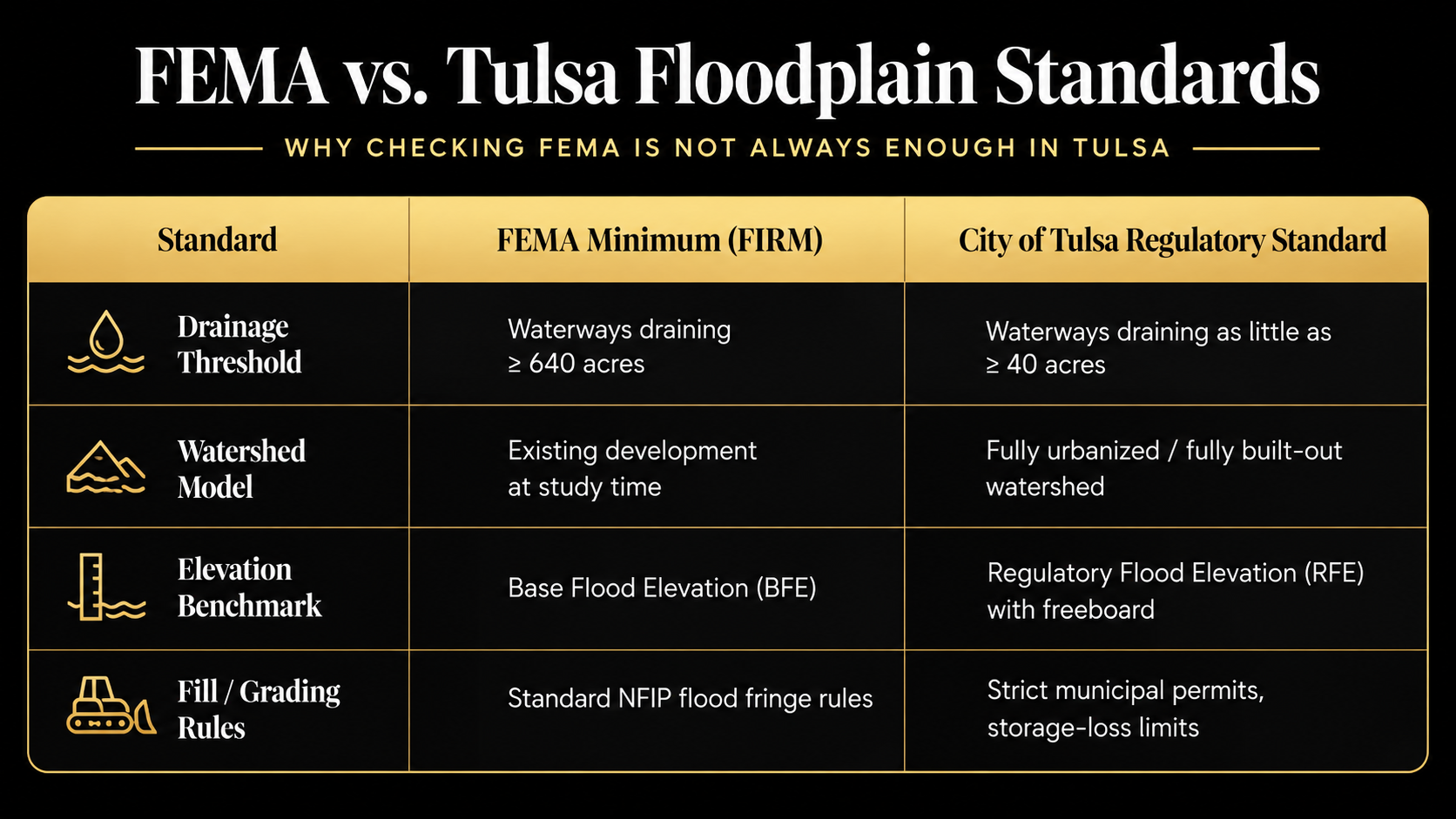
Large Drainage Basins: FEMA generally limits detailed hydraulic modeling to waterways draining 640 acres (one square mile) or more. Unnamed creeks, ravines, and local swales draining smaller areas are often omitted.
Current-State Snapshots: FEMA calculates runoff based on development existing at the time of the study, rather than anticipating future upstream construction.
Long Revision Cycles: Updates can take 5 to 15 years to finalize, meaning fast-growing suburban corridors often outpace published maps. State-level resources from the Oklahoma Water Resources Board (OWRB) Floodplain Management Division frequently remind property owners that local conditions change faster than federal maps.
3. The 1984 Memorial Day Flood: Why Tulsa Set Its Own Rules
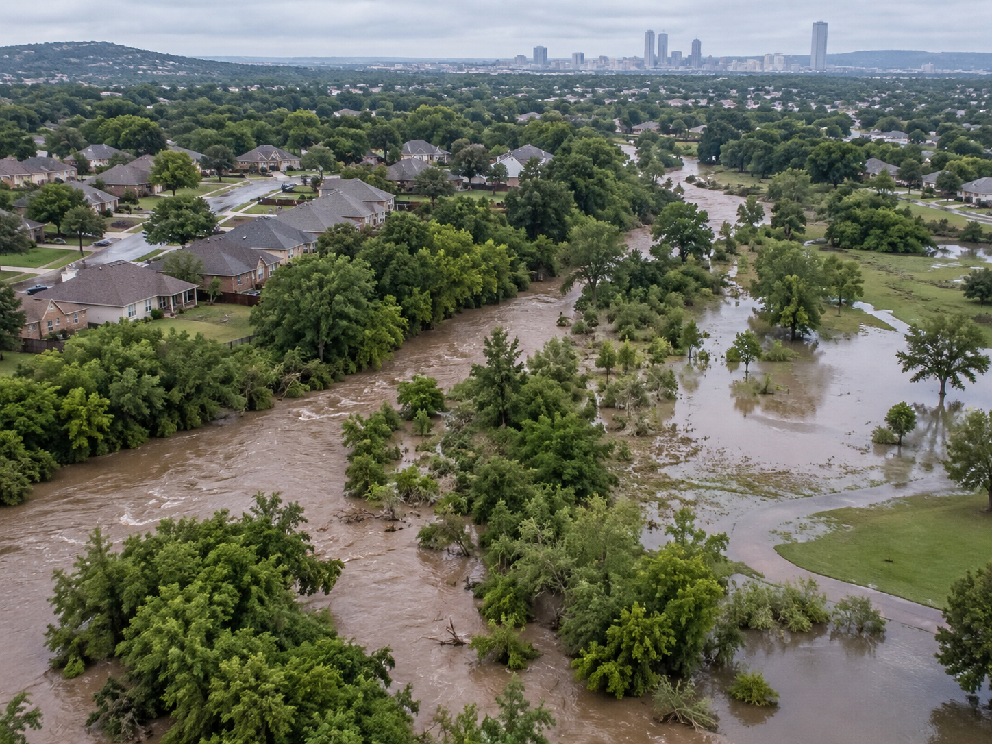
Tulsa’s independent approach to stormwater management stems from hard experience. Between 1970 and 1984, the city experienced nine federally declared flood disasters. Rapid suburban growth had replaced open prairie with asphalt and rooftops, funneling enormous runoff volumes directly into narrow creek beds.
On Memorial Day weekend in 1984, a stalled storm dropped 10 to 15 inches of rain over Tulsa in just eight hours. Mingo Creek overflowed catastrophically. The flood claimed 14 lives, injured 288 people, and damaged or destroyed more than 7,000 buildings, causing over $180 million in damage.
A Higher Standard of Floodplain Management
Following the disaster, Tulsa overhauled its stormwater strategy. The city purchased and cleared thousands of repetitive-loss homes along Mingo Creek, converting the land into permanent green spaces, parks, and retention basins.
Crucially, Tulsa developed its own proprietary Regulatory Floodplain Map Atlas.
Today, Tulsa is recognized under FEMA’s Community Rating System (CRS) as a Class 1 community—one of only two nationwide. This status grants Tulsa property owners up to a 45% discount on NFIP flood insurance policies in Special Flood Hazard Areas, but it also means the city enforces rules far stricter than federal baselines under Title 11-A of the Tulsa Revised Ordinances (TRO).
4. Step 2: Check the City of Tulsa Regulatory Floodplain
Because Tulsa uses stricter criteria, buyers frequently encounter a surprising scenario:
A property can sit in FEMA Zone X (unshaded, no lender insurance required), yet fall squarely within the City of Tulsa Regulatory Floodplain.
Here is why local city maps capture risk that federal maps overlook:
Tulsa Models the Small Streams
A stream draining 60 to 100 acres can generate dangerous, high-velocity water during a sudden downpour. Tulsa maps and regulates these smaller channels down to a 40-acre drainage threshold, capturing corridors that FEMA leaves unshaded.
Tulsa Assumes Upstream Land Will Be Paved
FEMA bases its calculations on current ground conditions. Tulsa’s engineers ask a different question: What happens when every acre upstream is eventually cleared, paved, and built out?
Because roofs and pavement prevent natural absorption, runoff volumes and velocities increase dramatically. By modeling watersheds as fully urbanized, Tulsa’s Regulatory Flood Elevation (RFE) is routinely higher and covers a wider area than FEMA’s Base Flood Elevation.
5. What Happens If Your Land Is in Tulsa’s Regulatory Floodplain?
Discovering that a property sits inside Tulsa’s regulatory footprint carries practical, financial, and legal implications.
1. The Flood Threat Is Real
A city regulatory designation is not arbitrary; it means municipal models show that water will gather or flow across the parcel during significant storms. Monitoring real-time area stages through tools like the USGS Streamgage - Arkansas River at Tulsa shows how rapidly local runoff travels.
2. Building Permits and Outbuildings Face Strict Standards
Planning to add a workshop, detached garage, pool, or home addition? If the building footprint falls within the regulatory floodplain, the city enforces specific requirements:
Elevation Rules: Finished floors and mechanical equipment must sit at or above the city’s Regulatory Flood Elevation (RFE), including required safety buffers (freeboard).
Elevation Certificates: Owners can check the City of Tulsa Elevation Certificate Database to see if a record already exists, or retain a licensed surveyor to establish one.
Permitting Guidelines: Review the City of Tulsa Infrastructure Development Process before grading, as standard plans may require engineered flood vents or elevated stem walls.
3. Dirt Work and Fill Are Regulated
Bringing in dirt to fill a low, wet corner without a permit is illegal in Tulsa's regulatory floodplain. Placing fill reduces channel storage capacity, diverting water onto neighboring parcels or city roads. Unpermitted grading can bring stop-work orders, fines, and civil liability under Oklahoma drainage laws.
6. The 4-Stage Buyer Verification Checklist
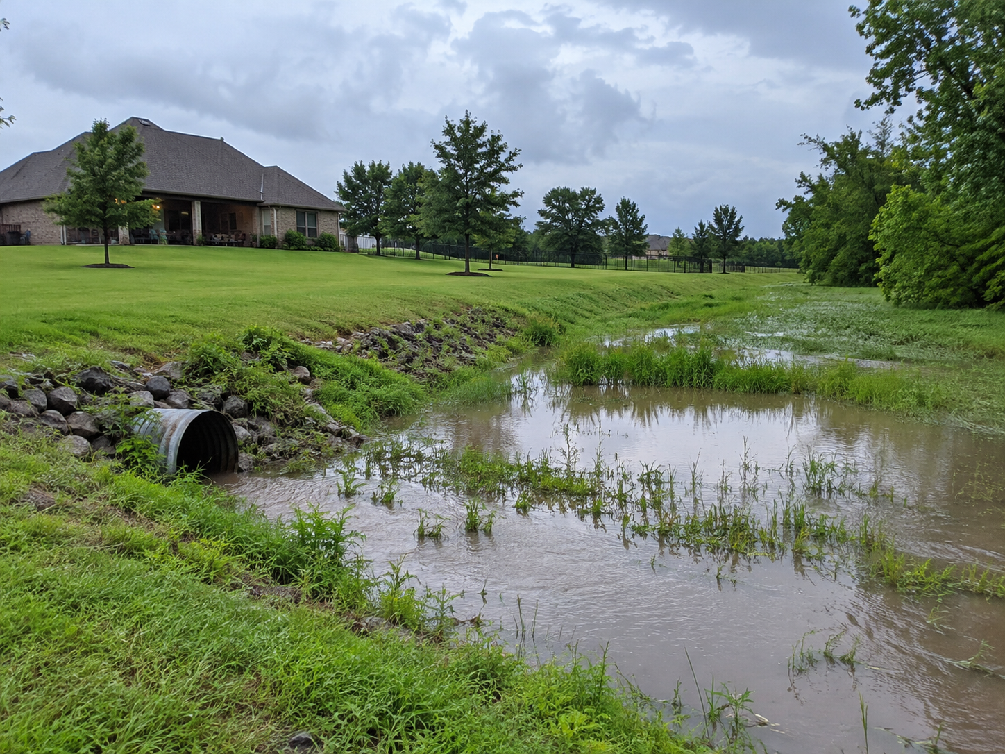
Before removing contract contingencies on a Tulsa-area home or acreage property, follow this four-stage review:
Stage 1: Confirm the Federal Baseline
Look up the address at msc.fema.gov.
Determine if the home is in Zone A, AE, or X.
Verify whether your mortgage lender will require flood insurance.
Stage 2: Check the Local City Atlas
Search the City of Tulsa Regulatory Floodplain Map Atlas or contact the city at 311.
Check whether the parcel touches a 40-acre drainage path or regulatory floodway.
Compare the Regulatory Flood Elevation (RFE) to your building site.
Stage 3: Inspect the Ground in Person
Walk boundary lines to locate natural swales, ditches, and culverts. (Related: See The Fence Has Been There for 20 Years. That Doesn't Mean It's the Property Line before relying on old fence rows).
Check driveway pipes and culverts for silt accumulation or rust failure. (Related: Review The Driveway Is on the Property. But Do You Actually Have the Right to Use It? for legal access tips).
Look for debris lines along fences and trees that indicate recent high-water marks.
Confirm that soil slopes away from the foundation at least 6 inches over the first 10 feet.
Stage 4: Quote Voluntary Flood Coverage
Standard homeowner's insurance policies do not cover flood damage. Consult the Oklahoma Insurance Department (OID) Flood Insurance Guide to understand standard exclusions and waiting periods.
Request a flood insurance quote through the NFIP or private carriers.
Benefit from Tulsa's Class 1 CRS designation, which lowers policy costs.
7. Frequently Asked Questions (FAQs)
Can a property flood if FEMA maps it as Zone X?
Yes, absolutely. Zone X means the property has less than a 0.2% annual chance of flooding from major river systems studied by FEMA, but more than 25% of all national flood insurance claims occur directly inside Zone X due to intense flash floods, unmapped local creeks, and overloaded storm sewers.
Does Tulsa have its own flood maps separate from FEMA?
Yes, Tulsa maintains an independent Regulatory Floodplain Map Atlas. Created after the destructive 1984 Memorial Day flood, the city’s atlas tracks smaller drainage basins down to 40 acres (compared to FEMA’s standard 640-acre threshold) and models future water levels assuming fully urbanized upstream development.
Will my lender require flood insurance if my home is only in Tulsa’s Regulatory Floodplain?
No, federal mortgage rules only require insurance inside FEMA-designated Special Flood Hazard Areas (Zone A or AE). However, while your bank may not mandate coverage, the physical risk of flooding remains, making voluntary flood insurance an important financial safeguard.
Can I build an outbuilding or shop if my land is in Tulsa’s Regulatory Floodplain?
Yes, but only if you comply with city building and elevation requirements. The City of Tulsa requires building plans to elevate the lowest finished floor at or above the Regulatory Flood Elevation (RFE), verified by an official elevation certificate from a licensed surveyor.
Can I bring in dirt to fill a low, wet spot on my Tulsa property?
No, not without an approved permit from the city. Adding fill dirt inside a regulatory floodplain or floodway reduces natural stormwater storage and can push water onto adjacent lots, leading to stop-work orders, municipal fines, and potential neighbor disputes.
Final Thoughts
A standard homeowner's insurance policy excludes water damage from rising surface water. If four inches of rain rushes through your patio doors, you pay for the cleanup and repairs yourself.
Do not let an unshaded FEMA map create a false sense of security. Start with FEMA to check lender requirements, but always verify the City of Tulsa Regulatory Floodplain before closing. Knowing how water actually moves across your land ensures your home remains safe and dry.
Related Guides:
The Driveway Is on the Property. But Do You Actually Have the Right to Use It?
The Fence Has Been There for 20 Years. That Doesn't Mean It's the Property Line
Disclaimer: This article is provided for educational purposes only and does not constitute engineering, hydrological, or legal advice. For specific property concerns, consult a licensed civil engineer, surveyor, or an attorney licensed in Oklahoma.
